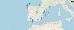
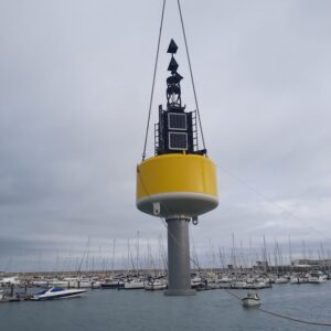
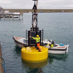
In Situ TAC starts leveraging oceanographical data recorded as part of a pilot study between Met Éireann and Commissioners of Irish Lights for retrofitting 4 Aid to Navigation (AtoN) buoys with oceanographic equipment, called IL1-4 Navigation stations.
Covering the coastal line of Ireland from West coast (IL1, IL2) , North East coast (IL3) to South East coast (IL4), this network integrates a wide range of instruments mounted in the buoys that monitor physical, wave and meteorological parameters. After feeding a near-real-time dataflow, both real-time observations and historical data are available to be collected through an open-source interface.
Since June 2025 time series corresponding to these 4 coastal buoys are distributed through the following In Situ TAC MultiYear NRT products:
- INSITU_GLO_PHYBGCWAV_DISCRETE_MYNRT_013_030
- INSITU_IBI_PHYBGCWAV_DISCRETE_MYNRT_013_033
- INSITU_NWS_PHYBGCWAV_DISCRETE_MYNRT_013_036
And in November 2025 the time series will be integrated into the Multi Year reprocessed product for Waves, INSITU_GLO_WAV_DISCRETE_MY_013_045, after a thorough process of validation.