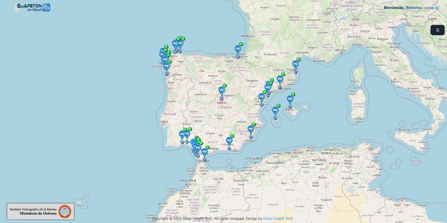
Into the frame of a fruitful collaboration with Instituto Hidrografico de la Marina (Spain), the tide gauge network deployed by this institution along the coastal line of Spain is starting to be integrated into the Copernicus Marine Service catalogue.
The Instituto Hidrografico de la Marina, as an organization under the Navy Staff, constitutes the national hydrographic service aimed to promote cartography and achieve wider action in all functions related to hydrography and navigation.
The deployment of this network responds to the aim of the Instituto Hidrografico de la Marina for systematic observation and study of tides and currents, temperatures and acoustic and electromagnetic propagation in seawater, meteorology and all physical features affecting navigation. More specifically, this tide gauge network is linked to the project for creating, developing and quality control a new Hydrographic Vertical Reference Surface.
In a first stage, 4 pilot stations in the south coastal area has been selected and their data flows distributed in near-real time: Cádiz Puntales, Cádiz Puerto América, Rota y Barbate.
Once the integration evolves, more stations will be added to the catalog, trying to cover the whole extension of the Spanish coast.
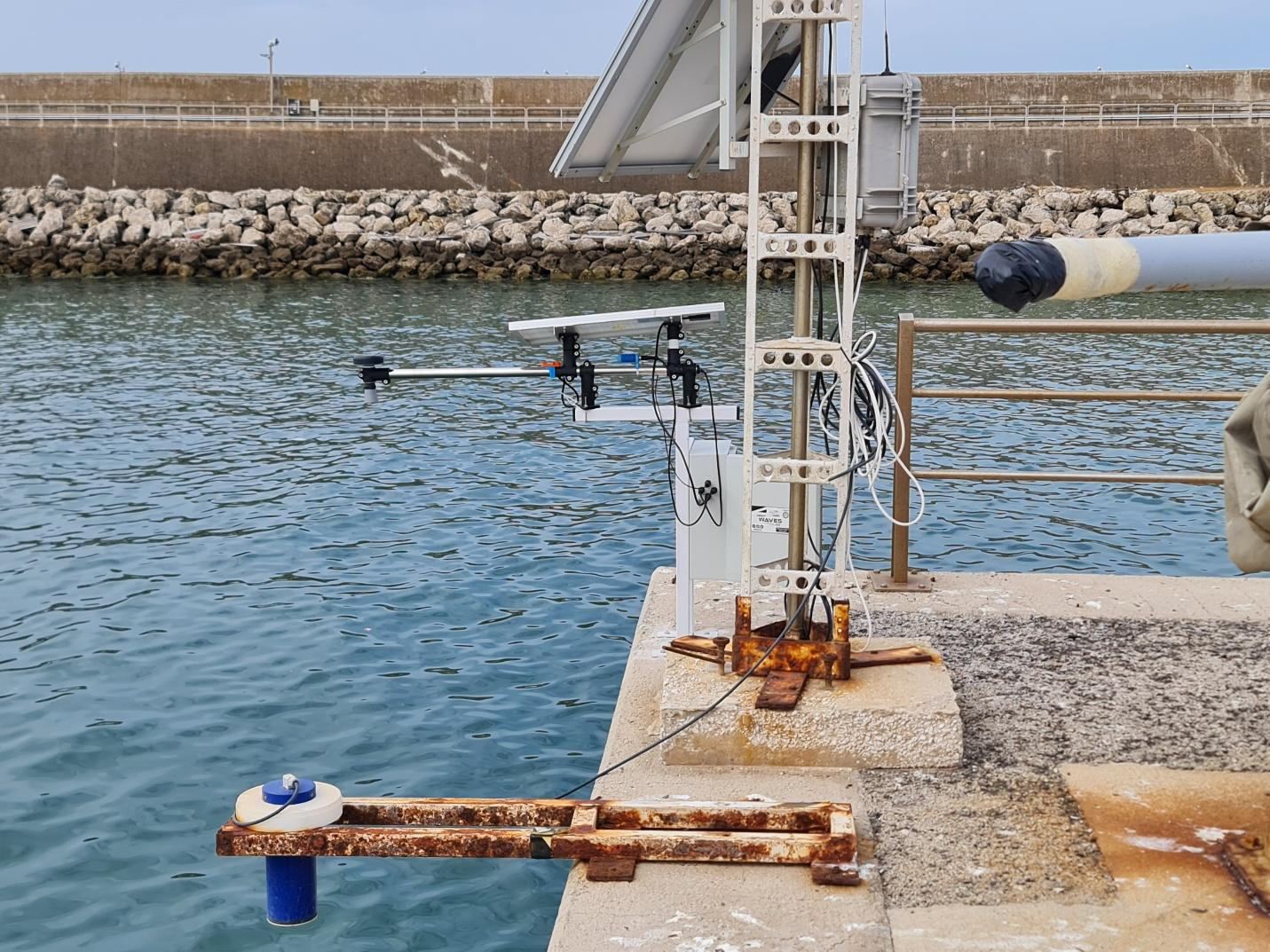
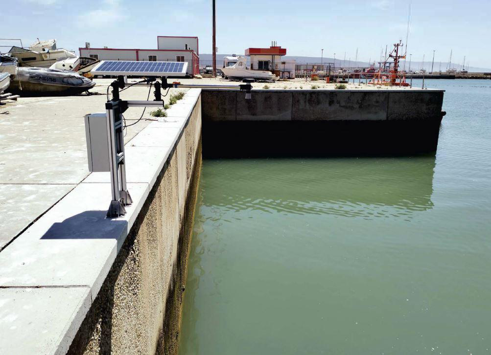
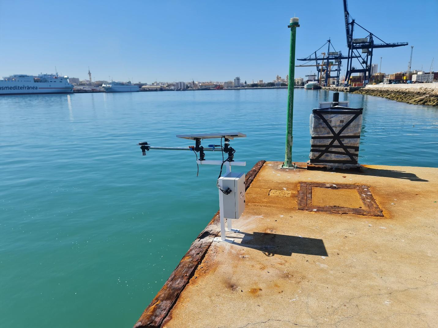
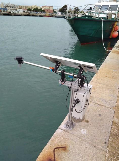
Supporting the operation of this network, there is a new technology designed in collaboration between the Instituto Hidrografico de la Marina and the company Deep Insight, integrating an acoustic sensor for gauging sea level data, a GNSS device (Global Navigation Satellite System) for measuring vertical land motion and meteorological sensors.