The November 2026 release of the Multi-Year Sea Level product (INSITU_GLO_PHY_SSH_DISCRETE_MY_013_053) introduces a new dataset of daily mean sea level time series from tide gauges, corrected for vertical land motion (VLM).
Why is correcting for vertical land motion important?
Tide gauges are anchored to the land, often on coastal infrastructure, and measure sea level relative to the ground on which they are installed. When the land moves vertically, the instrument moves with it, and the recorded signal combines changes in sea surface level with land subsidence or uplift.
Both components reflect real geophysical processes: changes in ocean volume, for example due to land ice melt, contribute to sea level rise, while land subsidence also causes relative sea level to rise and land uplift has the opposite effect.
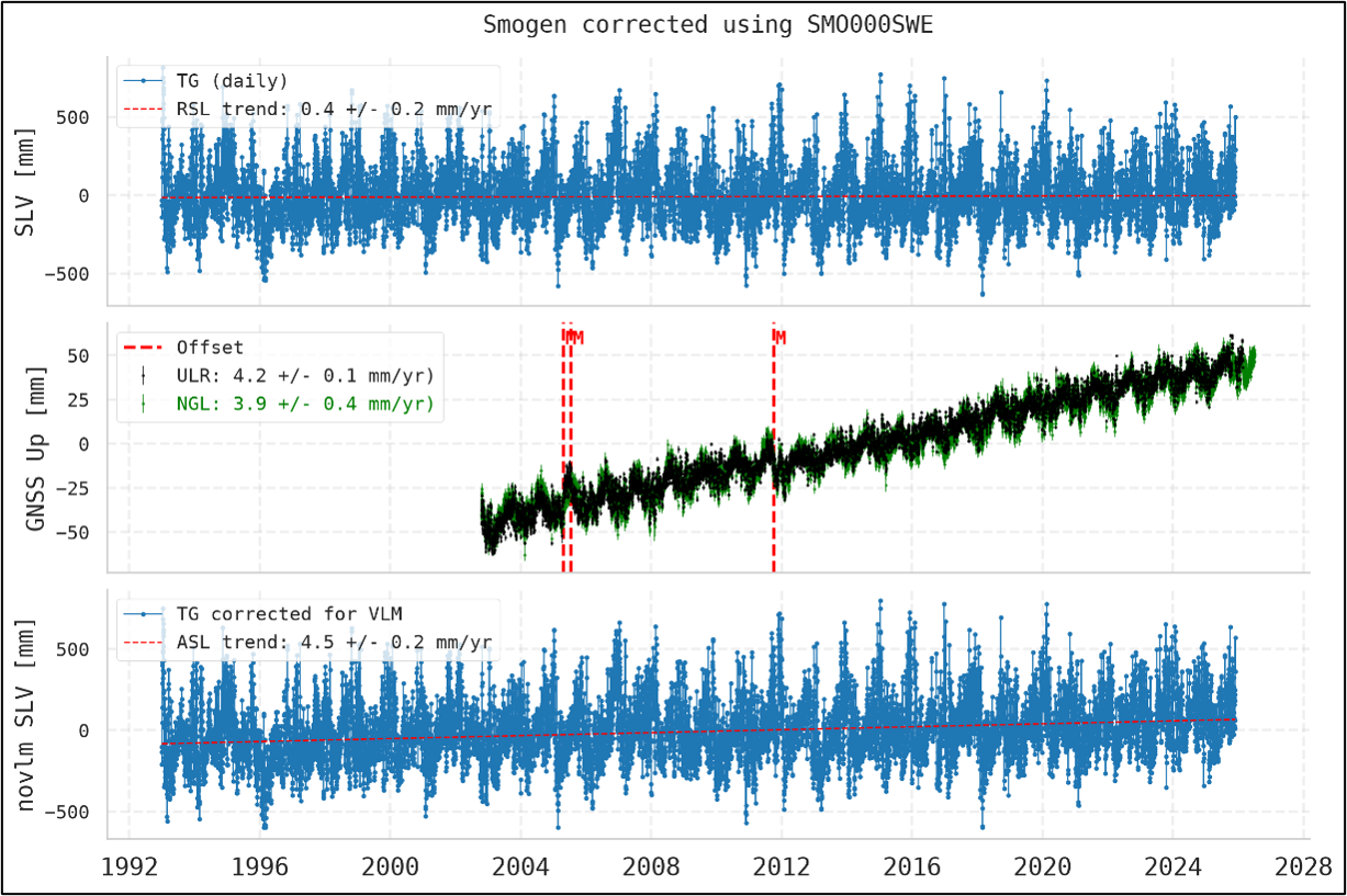
Depending on the location, vertical land motion can contribute to relative sea level changes of the same order of magnitude as ocean-driven changes, or even dominate them (Figure 1). Correcting for VLM is therefore essential when comparing tide gauge observations with satellite altimetry data or ocean model predictions, which describe sea level changes without the local contribution of land motion.
How is vertical land motion estimated?
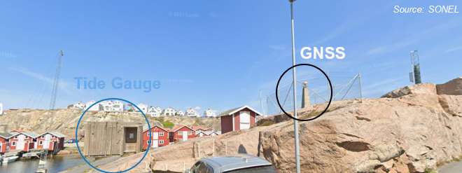
Continuously operating GNSS stations can provide precise estimates of vertical land motion in a geocentric reference frame, such as the International Terrestrial Reference Frame (ITRF) used in satellite altimetry, provided that their observations are processed using appropriate models, corrections and analysis strategies, in accordance with the standards recommended by the International GNSS Service (IGS).
For the demonstration phase associated with the November 2026 release, we deliberately adopted restrictive selection criteria, prioritising cases where VLM can be reliably characterised.
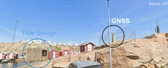
GNSS stations had to be located within 1 km of a tide gauge, to minimise potential differences in vertical land motion between the two sites, and have more than three years of observations showing a linear vertical trend.
This linearity is particularly important because it allows the estimated VLM correction to be extrapolated over the full satellite altimetry era, from 1993 to the present, even when GNSS observations cover only part of this period. This approach assumes that the underlying vertical land motion remains approximately linear over the period considered.
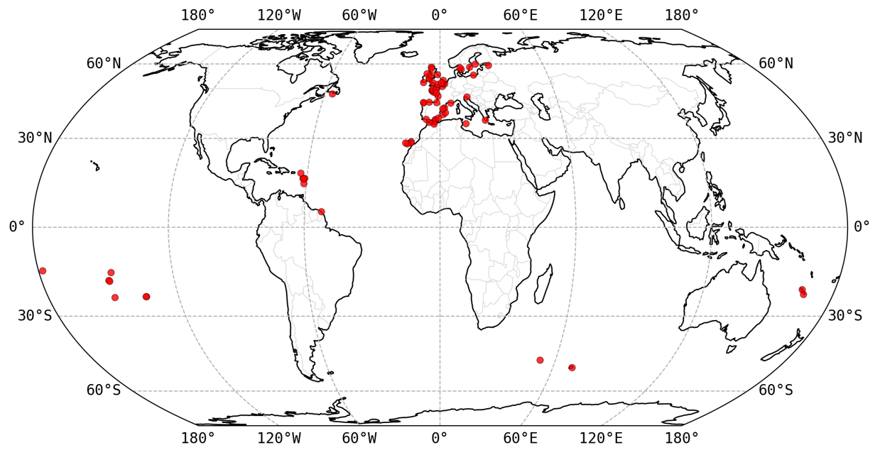
These criteria resulted in 101 daily tide gauge time series corrected for VLM (Figure 2).
A first step towards improved sea level monitoring
The co-location of GNSS receivers with tide gauges has been a key recommendation of the IOC’s Global Sea Level Observing System (GLOSS) since 2012, as it makes it possible to separate relative from geocentric sea-level changes. It is also identified as a priority in the GLOSS Implementation Plan 2026.
This release is an important step towards putting that recommendation into practice: for the first time in the Copernicus Marine portfolio, tide gauge observations are corrected for VLM using GNSS measurements.
These corrected records are better suited to monitoring long-term sea-level change and to assessing how climate change contributes to relative sea-level trends.
Towards broader coverage of VLM-corrected tide gauge records
The new dataset could be expanded substantially in a future phase of Copernicus In Situ TAC by incorporating complementary observations, such as precise levelling, InSAR and GNSS interferometric reflectometry (GNSS-IR), potentially increasing the number of corrected stations by 50% or more.